What States Make Up New England? (Fun Facts)

New England is much more than just a collection of 6 states in the northeast of the United States. It is a region with a fascinating history and culture.
In this post we will explore not only what 6 states make up New England, but also some unique facts and common questions about the New England region, how it earned its name, and some of the differences between each of the New England states.
Contents
Advertising Disclosure: What States is a for profit reference website, supported by advertisements. Thank you for supporting our mission to make geography fun for all!
What States Make Up New England?
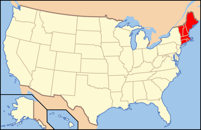
New England is made up of 6 states: Maine, Vermont, New Hampshire, Massachusetts, Connecticut, and Rhode Island. The New England region is located in the upper northeast corner of the lower 48 United States, and bordered by New York, Canada, and the Atlantic Ocean.
Where Is New England Located?
New England is a region of the United States located in the upper northeastern corner of the lower 48 states. Here is a map highlighting the 6 states – Maine, Vermont, New Hampshire, Massachusetts, Connecticut, and Rhode Island- that together comprise the New England region:
Fun Facts About New England
The New England region is an absolutely fascinating one for lovers of geographic trivia.
For a region that is made up of 6 complete stations, New England is actually a pretty small region of the United States. The six New England states have a combined area of 71,992 square miles, which means that all the New England states put together are still 10,000 square miles smaller than the single state of Kansas!
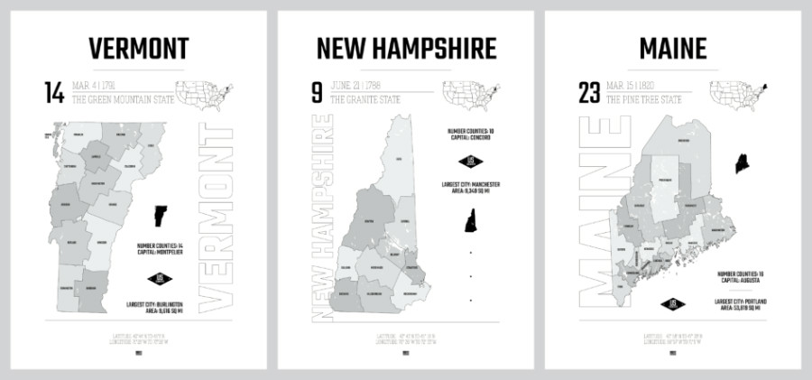
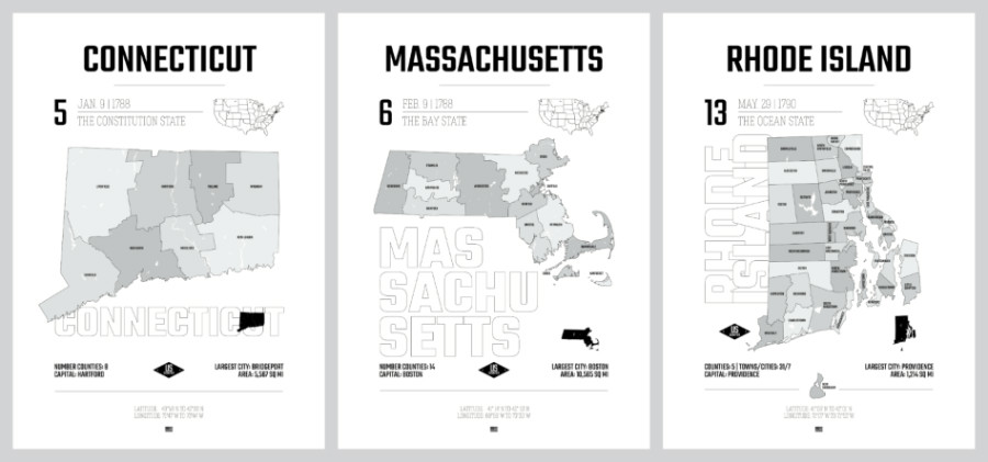
Why is New England called New England?
New England was originally called the Plymouth Colony, which was established in 1620 by English Puritans as one of the first English settlements in North America under a charter from the King of England.
The name “New England” was coined by the English settler John Smith in 1616 in his written work A Description of New England, and became the official name four years later with the charter for the Council of New England, a joint stock company given control of the territory. The name was meant to honor of King James of England.
History of New England
By the late 17th century, King James II started becoming concerned that the colonists were becoming a bit too independent. So, in an effort to assert more control over the New England colonies, he issued the Dominion of New England decree in 1686. The decree essentially combined the colonies (and later New York and New Jersey, two of the tri states) into a single political unit, following the Spanish viceroy model.
Several colonies were resistant to this, and it contributed to tensions with the British Crown that would simmer for a century before the American Revolutionary War.
Eventually the New England states that we now know today were formed and each was named for its own reasons, if you are interested you can find more info on that subject in this article by the New England Historical Society.
❓ Trivia Time: What States are East Coast? (We bet you’ll miss at least one state!)
Fast Facts About New England
- New England’s Population: 14.85 million as of 2019
- Time Zone: Eastern Standard Time (EST)
- Geographic Area: 71,992 square miles
- Major New England Cities: Boston, Portland
- Famous For: Prominent educational institutions like Yale and Harvard University, sandy beaches at Martha’s Vineyard, Acadia National Park, Maine lobster, Vermont is famous for maple syrup, rolling hills and rural areas in New Hampshire, Vermont’s Green Mountains, major cities like Boston … there is a lot to explore in New England. See our guide to what Massachusetts is known for.
- When to Visit New England: Late spring is a great time to visit New England for beautiful whether, while fall brings changing leaves and local festivals
- Abbreviations for the States in New England: ME, MA, RI, CT, VT, NH
FAQs About New England
What is the Largest State in New England?
Maine is the largest of these 6 states in the New England region, accounting for nearly half of New England’s land area while still only being the 39th largest state out of the 50 states in the U.S.
What Is the Smallest State In New England?
Rhode Island is the smallest state in the New England region, and also the smallest state in the whole United States. Rhode Island covers an area of just 1,214 square miles. Alaska, our largest state, by comparison is 663,300 square miles and is big enough to fit Rhode Island into it about 425 times!
What is the prettiest New England state?
The state of Maine has some of the prettiest shoreline in the region of New England, although all 6 states that make up New England are beautiful and popular tourist destinations known for their pretty natural landscapes.
What is the cheapest state in new england to live in?
Of the six states in the New England region, the state of Maine ranks as the most affordable according to the US News cost of living index, which ranks Maine as the 35th most affordable state in the USA. All 6 New England states are among the most expensive in the country.
What New England State Should I move to?
According to World Population Review, New Hampshire ranks as the best state to live in the New England region and the #2 state for healthcare, education, economy, and crime in the United States overall. All 6 New England states rate relatively high on livability indexes.
***
That’s it to the guide to what states are in New England! I hope you learned something new about this incredible region of the US.
👉 For more fun geography trivia, check out our guide to what states are considered part of the “South”. It might surprise you how controversial the definition of the US “South” – just like the definition of the Bible Belt states – actually is!

